Koh Thalu: Swim-Through Caves in Chumphon's Pierced Island
23 เมษายน 2569
A small limestone island in Mu Koh Chumphon National Park with a massive cavern punched clean through the rock — plus a heart-shaped cave, dense anemone colonies, and blacktip reef sharks on the deeper margins.
A Limestone Island with a Hole Through Its Heart
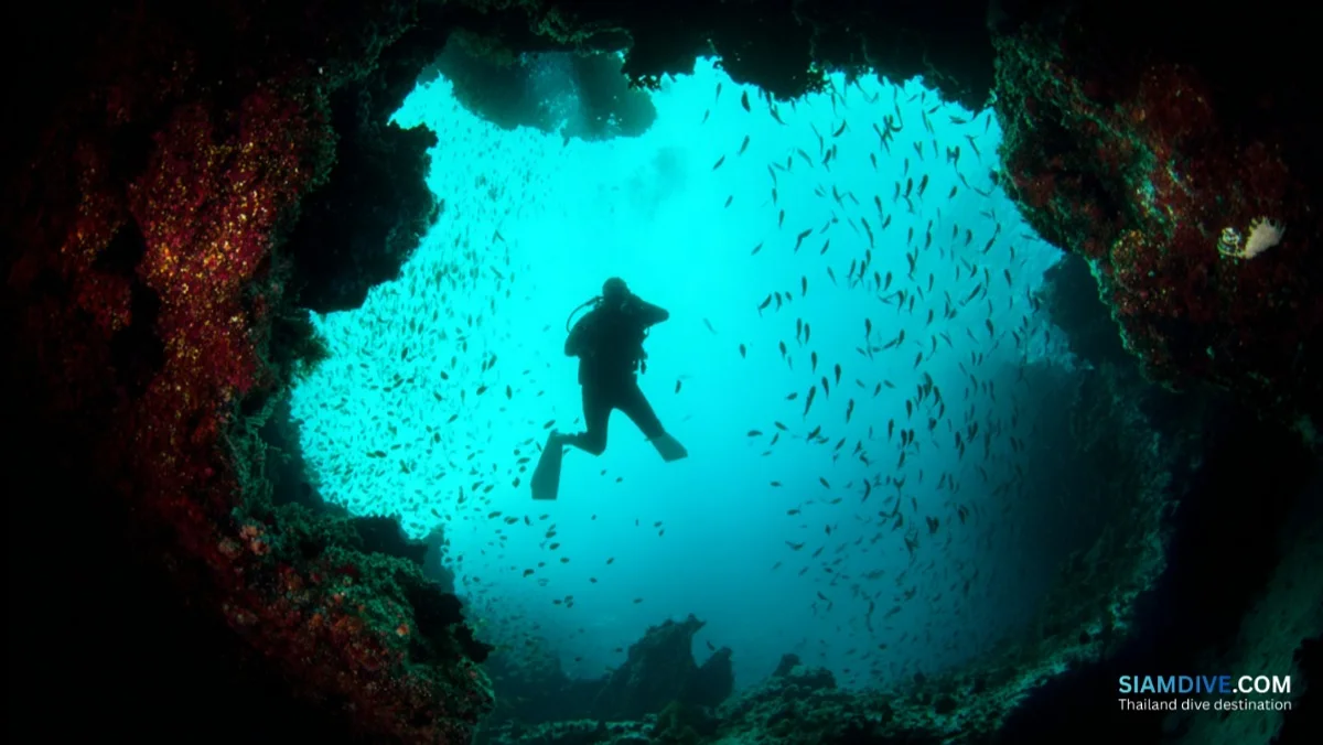
Thirteen kilometres off Pak Nam Chumphon, a small limestone outcrop rises from the Gulf of Thailand with a feature so dramatic it became the island's name. A massive cavern, carved by centuries of wave action, punches clean through the rock from one side to the other. At certain tides, snorkelers and divers can pass through the opening and emerge on the opposite face of the island — light streaming in from both ends. The Thai word for this geological puncture is thalu (ทะลุ), meaning "pierced" or "perforated," and Koh Thalu delivers exactly what the name promises: a rock formation that looks as though something enormous took a bite out of its centre.
Within Mu Koh Chumphon National Park — a protected marine area spanning more than 40 islands across the upper Gulf — Koh Thalu sits in the southern cluster, far from the day-trip crowds that gather at the more famous Ngam islands to the north. There is no beach to lounge on, no bungalow to check into. The island's steep limestone walls plunge directly into the sea on all sides, making it impossible to set foot on shore without climbing gear. It exists primarily as a dive site and geological curiosity, which is precisely what makes it worth the boat ride.
Most divers in Thailand have never heard of Koh Thalu. The island lacks the marketing machinery of Andaman destinations and the international dive-school infrastructure of Koh Tao. Yet its swim-through formation offers a topographic experience that neither of those regions can easily match — a natural rock tunnel framing open water at both ends, carved not by human engineering but by the patience of tides.
How Seawater Built a Swim-Through
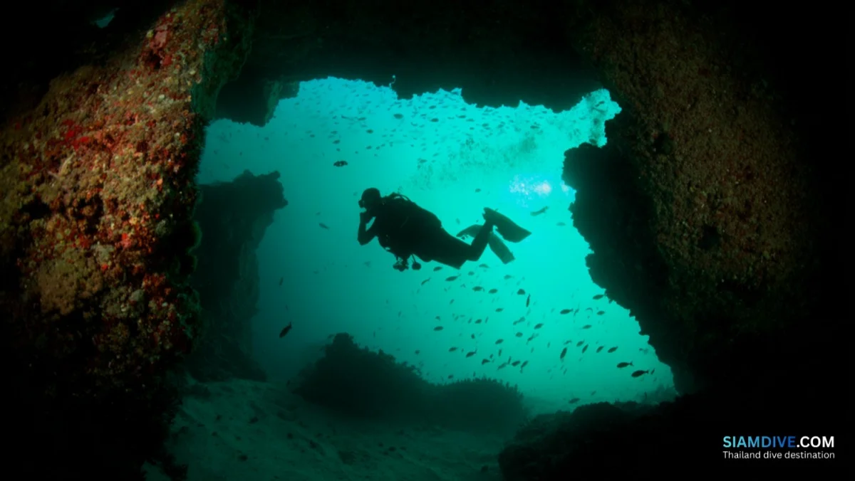
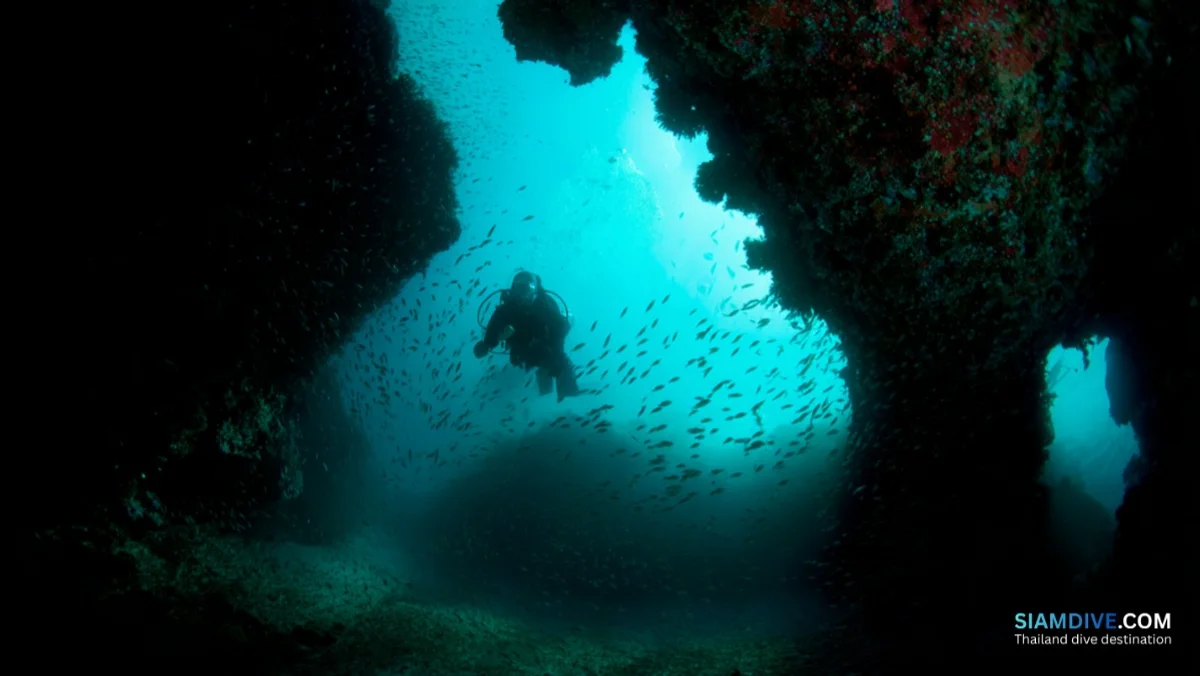
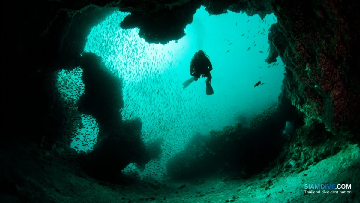
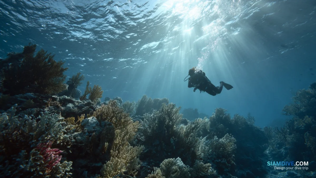
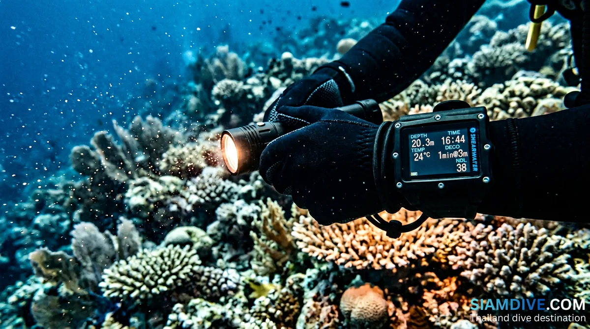
Koh Thalu's signature feature is the product of marine erosion working on soluble limestone over geological timescales. Waves, tidal surges, and slightly acidic seawater dissolved the calcium carbonate along fracture lines in the rock, gradually widening cracks into cavities, then cavities into full passages. The result is not a single neat tunnel but a complex of caverns and hollows that straddle the waterline. Some sections sit above the surface and can be observed from a boat; others extend below, requiring mask and fins to appreciate.
The most photographed feature is the central passage — large enough for a diver to swim through with gear, though conditions must be right. Surge, tide level, and visibility all dictate whether the passage is safely navigable on any given day. On the opposite side of the island, a second cavern opens with an entrance shaped unmistakably like a heart. This quirk of erosion has turned a geological process into social-media gold, though the formation itself predates Instagram by a few million years.
- Formation type: Limestone karst erosion (marine)
- Passage clearance: Large enough for equipped divers at favourable tides
- Heart-shaped cave: Opposite face of island, visible from the surface
- Light effects: Sun visible through the central hole at sunrise and sunset
What Lives Around the Rock
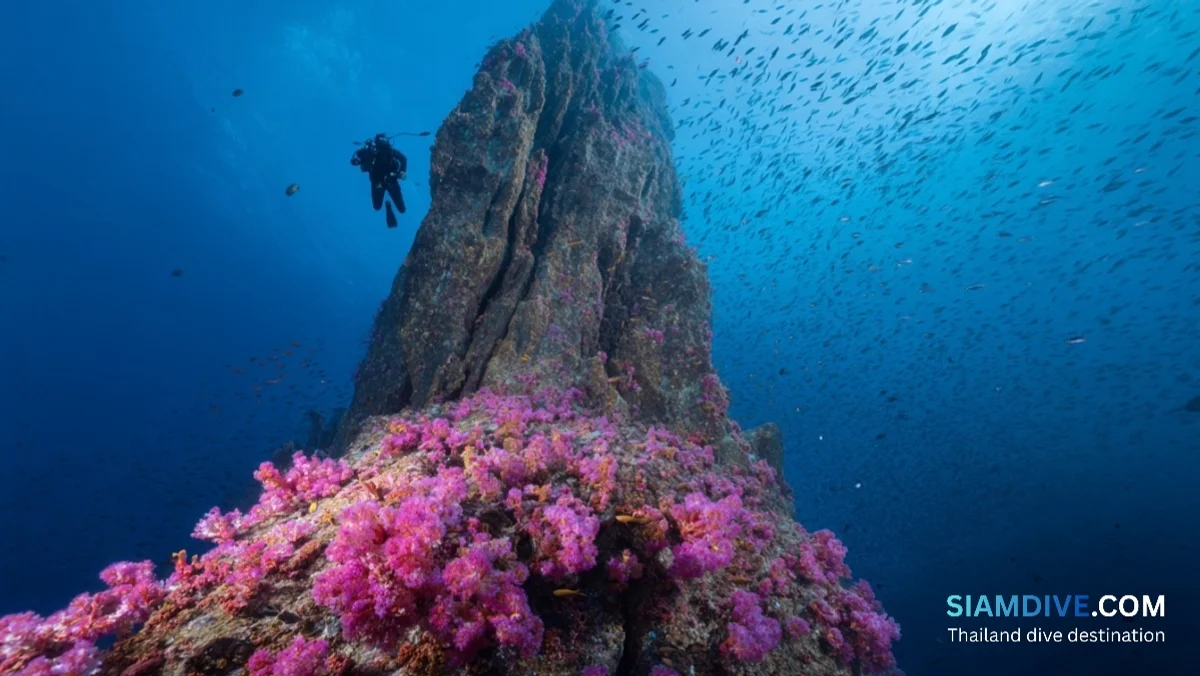
The eroded limestone creates a textured underwater topography — overhangs, ledges, crevices, and rubble fields — that supports a density of marine life disproportionate to the island's modest size. Sea anemones are the headliner here. Chumphon's waters host anemone species and colour morphs rarely seen elsewhere in the Gulf, and the sheltered nooks around Koh Thalu provide ideal attachment points. Resident clownfish (Amphiprion spp.) occupy nearly every colony.
Hard corals dominate the shallows: staghorn coral (Acropora) forms thickets in the 3–6 metre range, brain coral (Platygyra) encrusts the more wave-exposed surfaces, and flower corals add colour to the rubble zones. According to data from the Department of Marine and Coastal Resources (DMCR), the waters of Mu Koh Chumphon National Park support the highest diversity of fish species in the Gulf of Thailand — a claim substantiated by the sheer variety visible on a single dive around sites like Koh Thalu.
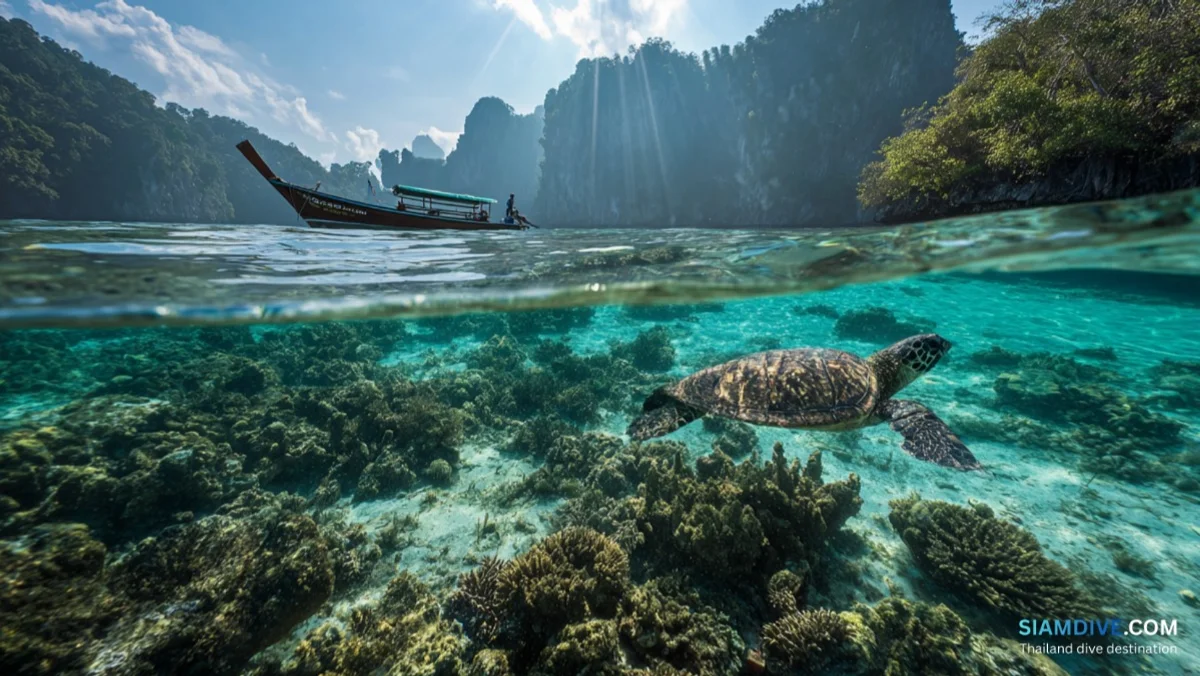
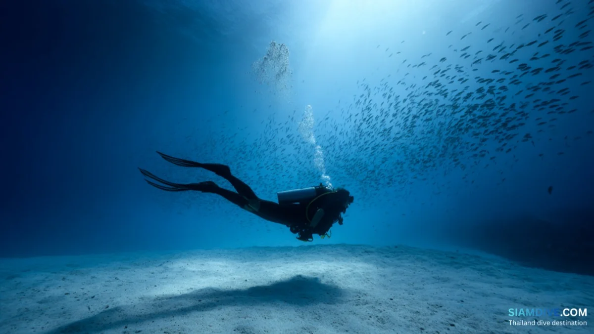
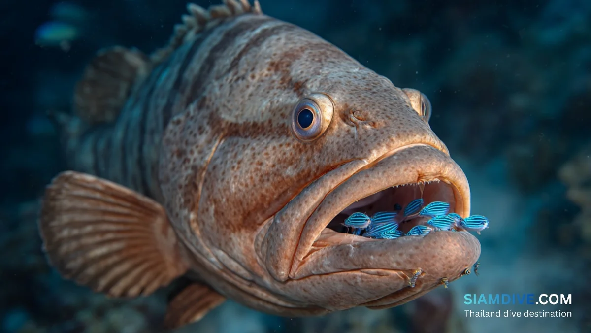
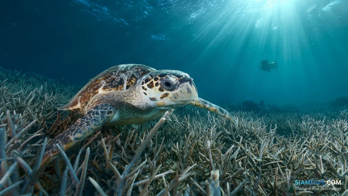
The fish assemblage here leans toward reef residents rather than pelagics. Schools of fusiliers stream past in silver curtains. Angelfish, butterflyfish, and parrotfish work the coral heads. Blue-spotted stingrays rest on sandy patches between boulders. Cuttlefish hover in the mid-water, changing colour with every shift of attention. Giant clams sit wedged between coral heads in the shallower zones, their iridescent mantles flashing blue and green. Nudibranch hunters can find sea slugs on the rubble, and careful observers may spot the occasional hawksbill sea turtle cruising past the reef edge — the park is home to both green and hawksbill populations.
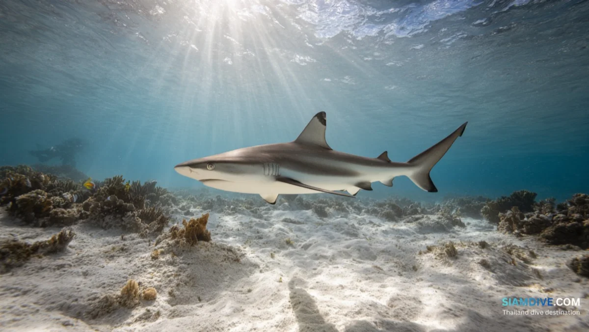
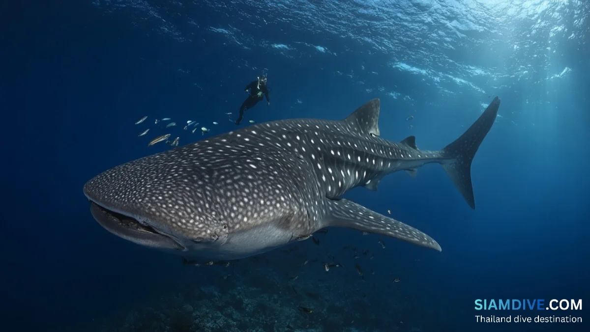
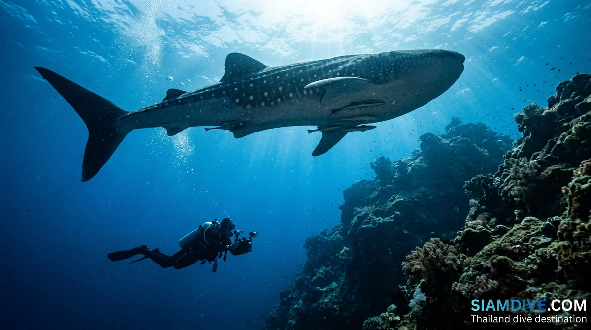
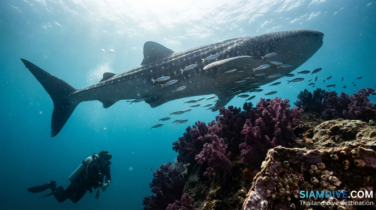
On good days, blacktip reef sharks patrol the deeper margins — typically at the 10–15 metre range south of the island, where the reef gives way to open sand. The sharks are generally timid and non-aggressive, maintaining a comfortable distance from divers, but their presence adds an unmistakable pulse to the dive. During the broader whale shark season (March through July, peak April–May), these gentle giants have been sighted at multiple locations across the park, and while Koh Thalu itself is not a primary encounter zone, adjacent sites like Koh Ran Ped and Ran Kai are just a short boat ride away.
Dive Site Profiles
Koh Thalu is compact enough that a single dive can cover its perimeter, but most operators split the site into two to three zones depending on conditions and group certification level.
- North face (cave/swim-through zone): Steep cliffs drop to 8–12 m. The main cavern and smaller overhangs are here. Best explored at slack tide when surge is minimal. Look for scorpionfish and stonefish camouflaged against the rock walls.
- West side (coral garden): Gentler slope, 5–10 m depth. Dense anemone colonies and hard coral gardens. Good for photography and suitable for Open Water-certified divers.
- South face (deep zone): The reef drops to 15–18 m over rubble and sand. Blacktip reef sharks and larger fish tend to appear here. More current-exposed, better suited for Advanced-level divers.
Two nearby islets — Koh Sing and Koh Sang — sit just west of Koh Thalu and are often combined into the same dive trip. These small rocks host extensive staghorn coral fields and serve as nesting grounds for seagulls, adding a topside wildlife dimension to the excursion.
- Depth range: 5–18 m
- Visibility: 10–20 m (best in May)
- Current: None to moderate
- Water temperature: 28–30 °C
- Level: All levels (north face swim-throughs recommended for experienced divers)
- Hazards: Fire coral, cone snails — standard tropical reef precautions
When to Go and How to Get There
Chumphon's dive season runs opposite to the Andaman coast. While Phuket and the Similans shut down for the southwest monsoon between May and October, the Gulf side of the peninsula opens up. March through September offers the best conditions at Koh Thalu, with May generally delivering the clearest water — visibility can exceed 20 metres on good days. The whale shark season at nearby Koh Ran Ped and Ran Kai peaks during April and May, making a combined itinerary tempting.
Boats to Koh Thalu depart from Pak Nam Chumphon (also called Laem Thaen or Ban Pak Klong pier), covering the 13-kilometre crossing in roughly 30–40 minutes. Most visitors encounter Koh Thalu as one stop on a multi-island snorkeling day trip through the national park — tours typically include stops at Koh Ngam Noi, Koh Ngam Yai, and Koh Kalok alongside Koh Thalu. Snorkeling day trips cost approximately 1,200–2,000 THB per person.
Scuba divers wanting to spend more time exploring the swim-throughs and deeper zones will need to arrange a dedicated dive boat through a Chumphon-based operator. Unlike mass-market destinations where a dozen boats jockey for mooring space, Koh Thalu on most days sees one or two boats at most — and some days none at all. This solitude is both the site's greatest advantage and its logistical challenge: there is no walk-in dive shop on the beach, and advance booking is necessary.
Getting to Chumphon is straightforward. The city has its own airport with domestic flights from Bangkok, a railway station on the southern line, and regular bus services. From Chumphon town, Pak Nam Chumphon pier is roughly 10 kilometres east. The national park entrance fee applies to all visitors.
Chumphon's Geology Trail — Above and Below
Koh Thalu belongs to a geological family. Across Mu Koh Chumphon National Park, limestone karst topography creates a connected story of erosion, colonisation, and reef-building. Hin Lak Ngam — roughly 20 kilometres northwest — showcases what happens when black coral colonises submerged rock formations, hosting Thailand's largest known concentration. Koh Mattra provides the park's snorkeling nature trail, with underwater signage guiding visitors through identified coral and fish stations. And Koh Lang Ka Jiw, another limestone outcrop, doubles as a swiftlet nesting cliff and dive site.
Together these sites illustrate how the same geological substrate — Permian limestone, uplifted and partially submerged — creates radically different underwater habitats depending on depth, exposure, and biological succession. Koh Thalu's contribution to this story is the swim-through: a feature where geology and diving converge in a way that is literally impossible to replicate at a flat-bottomed reef.
Conservation Notes
Mu Koh Chumphon National Park was formally established on 24 November 1989, covering marine and coastal areas along the Chumphon coastline. The park's legal protection means anchoring restrictions, collection bans, and visitor limits are in force — though enforcement intensity varies with season and staffing.
Koh Thalu's caverns present a specific conservation concern. Swim-through passages concentrate diver traffic through narrow spaces where accidental fin kicks and tank strikes can damage fragile encrusting organisms. Operators report that maintaining neutral buoyancy and avoiding contact with walls is essential — not just for conservation, but for safety when surge can push a diver into sharp limestone. The fire coral (Millepora) growing on several surfaces inside the passages delivers a memorable sting to exposed skin.
The island also serves as a nesting site for seabirds, particularly terns that breed in large numbers during March and April. Boat operators are expected to maintain distance from cliff-face nesting areas during this period. The proximity of Koh Sing and Koh Sang — the two satellite islets to the west — adds to the area's ecological significance, as these rocks also host seabird colonies and are being evaluated for potential inclusion in additional marine protection zones.
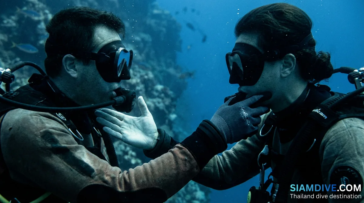
For divers, the practical takeaway is simple: treat the swim-through like a cavern environment. Stay horizontal, keep fins away from walls, and carry no dangling equipment that could snag on rock. The passage is short enough that overhead-environment training is not strictly required, but good trim and buoyancy control make the difference between a magical transit and a damaging one.
Planning the Visit
Koh Thalu works best as a half-day component within a broader Chumphon diving itinerary. The HTMS Prab 741 wreck sits south of Koh Ngam Noi and provides an entirely different dive experience — steel structure versus natural limestone. Combining wreck and reef in a single day gives divers two contrasting ecosystems and justifies the boat charter cost.
Chumphon remains one of Thailand's least-visited dive regions despite its national park status, its whale shark sightings, and its Gulf-season timing that fills the gap left by Andaman closures. Koh Thalu's swim-throughs are a compact example of why: they offer a topographic thrill that most Gulf sites simply cannot match, yet the island sees a fraction of the traffic that comparable formations attract in the Andaman Sea. For divers who have already explored Koh Ngam Yai's anemone fields or snorkeled the trail at Koh Mattra, Koh Thalu is the logical next stop — the island where the rock itself becomes the main attraction.