Why Counting Butterflyfish Matters More Than Planting Coral
27 เมษายน 2569
Reef Check trains recreational divers to run standardised reef surveys. The data shapes Thai marine park policy — any AOW diver can start in three days.
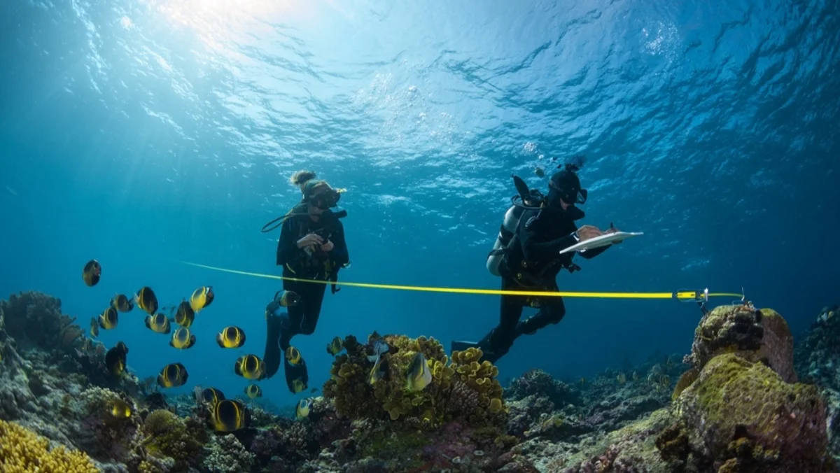
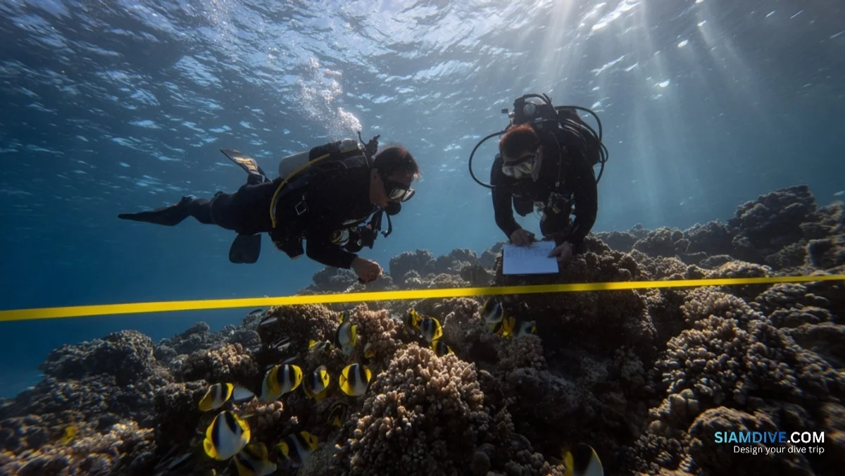
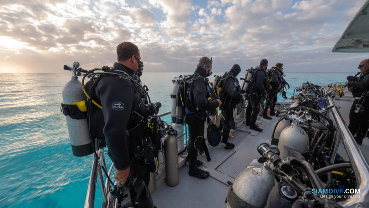
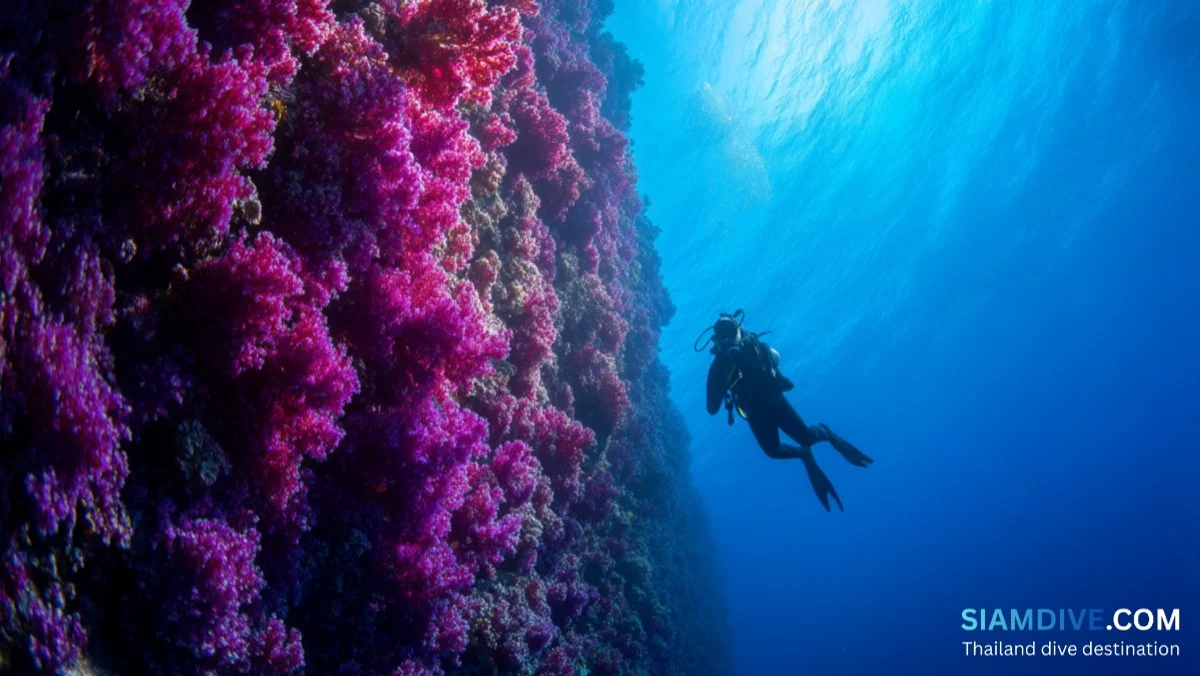
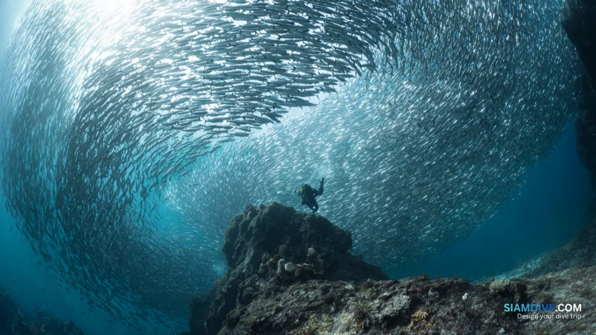
Two divers hover at five metres, one holding a yellow tape measure taut along the reef contour while the other scratches tally marks on a white slate. No wide-angle cameras, no macro lenses, no dive computers beeping through deco stops — just a 100-metre line, a pencil, and a checklist of 24 species. The procedure looks almost too simple. Yet data from surveys exactly like this one has closed fishing zones, triggered national park expansions, and reversed government decisions to permit resort construction on coral headlands across Southeast Asia.
The Clipboard That Outweighs a Coral Nursery
Reef restoration gets the headlines. Volunteers bolting coral fragments to concrete frames make compelling photographs for fundraising campaigns. But marine biologists have argued for decades that monitoring data changes policy faster than any nursery can regrow a reef.
Reef Check, founded in 1997 by marine ecologist Gregor Hodgson at UCLA, built its entire model on that insight. Rather than deploying professional scientists — expensive and scarce — the foundation trains recreational divers to run standardised surveys using a protocol rigorous enough for peer-reviewed journals. The resulting dataset spans more than 40,000 surveys across over 100 countries and constitutes the largest volunteer reef-monitoring programme in the world.
The logic is blunt: a reef that nobody measures is a reef that nobody manages. In Thailand, where more than 300 species of reef-building corals face repeated bleaching events, the gap between what reefs need and what government scientists can cover on their own is enormous. Reef Check fills that gap with trained volunteers who carry clipboards instead of coral fragments.
100 Metres of Tape, Four Windows into a Reef
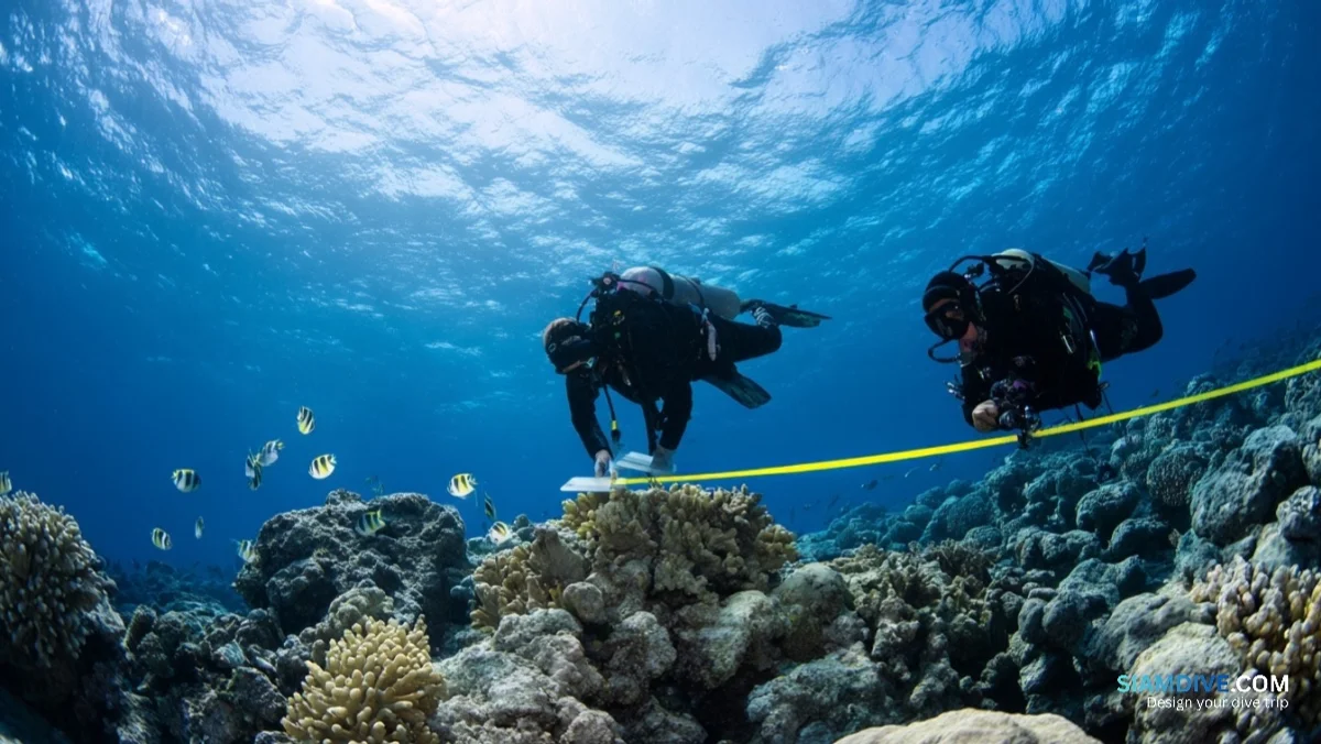
Think of the Reef Check transect the way a doctor thinks of a blood panel. A single snapshot of coral cover percentage tells you the reef is unwell — but not why. The transect protocol is designed to answer the why.
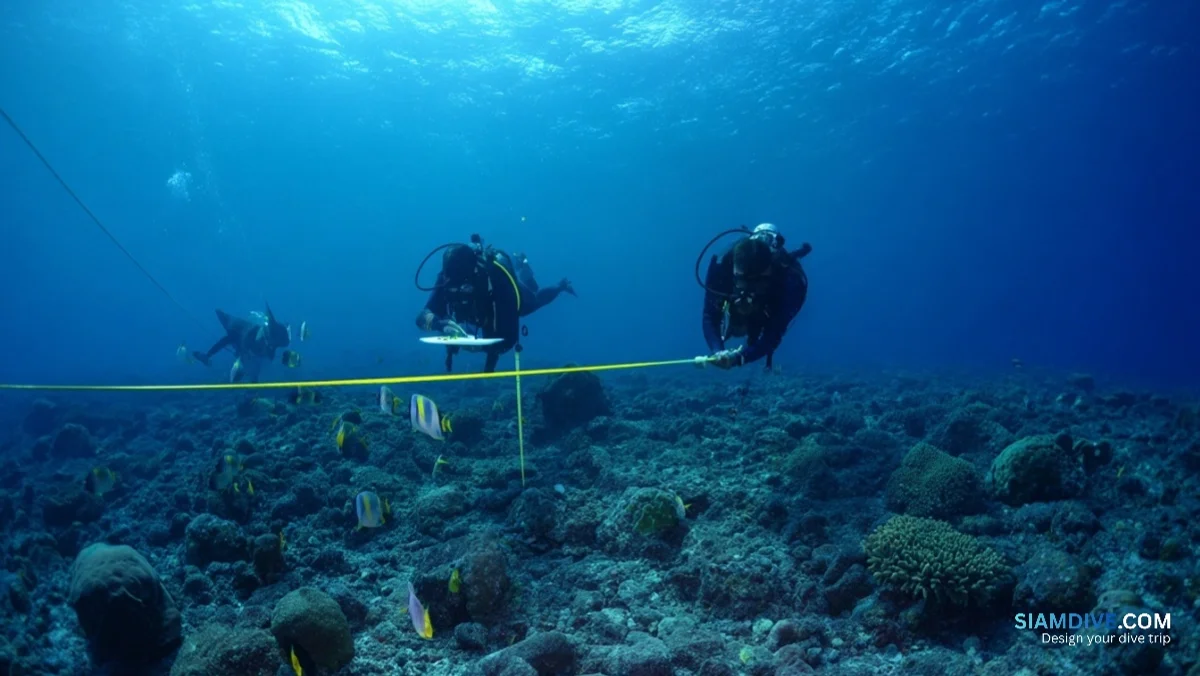
At each survey site, a team lays a 100-metre tape along the reef contour at a consistent depth. That line is divided into four 20-metre segments separated by 5-metre gaps. The gaps are not arbitrary; they prevent statistical pseudoreplication — the same way medical trials space blood draws to avoid retesting the same circulating sample.
Each segment is surveyed three ways:
- Fish belt — a 5-metre-wide corridor centred on the tape. Surveyors count indicator fish species within this corridor and up to 5 metres above the line.
- Invertebrate belt — same corridor dimensions. Surveyors record specific invertebrate species chosen for their sensitivity to human impact: sea urchins, giant clams, banded coral shrimp, lobsters, sea cucumbers.
- Substrate line — every 0.5 metres along the tape, the surveyor records what lies directly beneath: live hard coral, recently killed coral, nutrient-indicator algae, sponge, rock, rubble, or sand.
The result is not a photograph but a medical record. Run the same transect twice a year for five years and the data reveals not just whether the reef is healthy, but whether it is improving or declining — and which pressures are driving the change.
What 24 Species Tell You That Coral Cover Cannot
Reef Check tracks 16 global and 8 regional indicator organisms. Each was selected because it is easy for a trained non-scientist to identify underwater, ecologically significant, and a reliable signal of a specific human impact.
- Groupers over 30 cm — apex reef predators. Their absence signals overfishing. When large groupers vanish, prey species boom unchecked, algae-eating invertebrates decline, and algae colonise coral surfaces within months.
- Parrotfish over 20 cm — the reef's lawnmowers. They graze algae off dead coral, clearing settlement space for new coral larvae. A reef without parrotfish is a reef losing its capacity to regenerate.
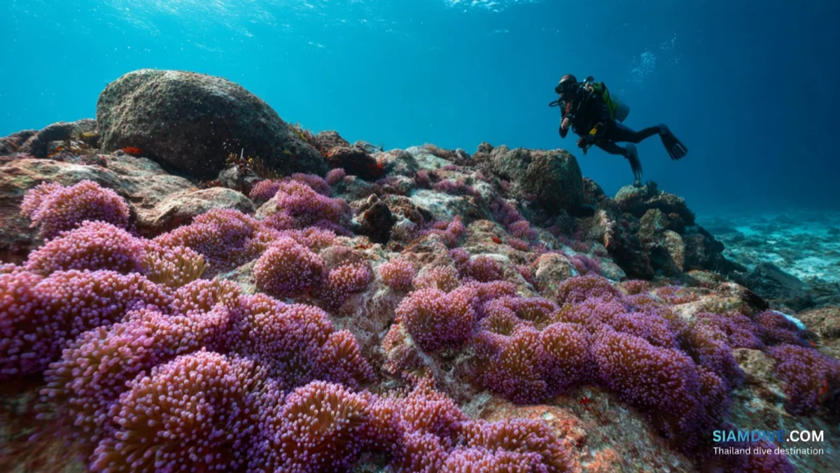
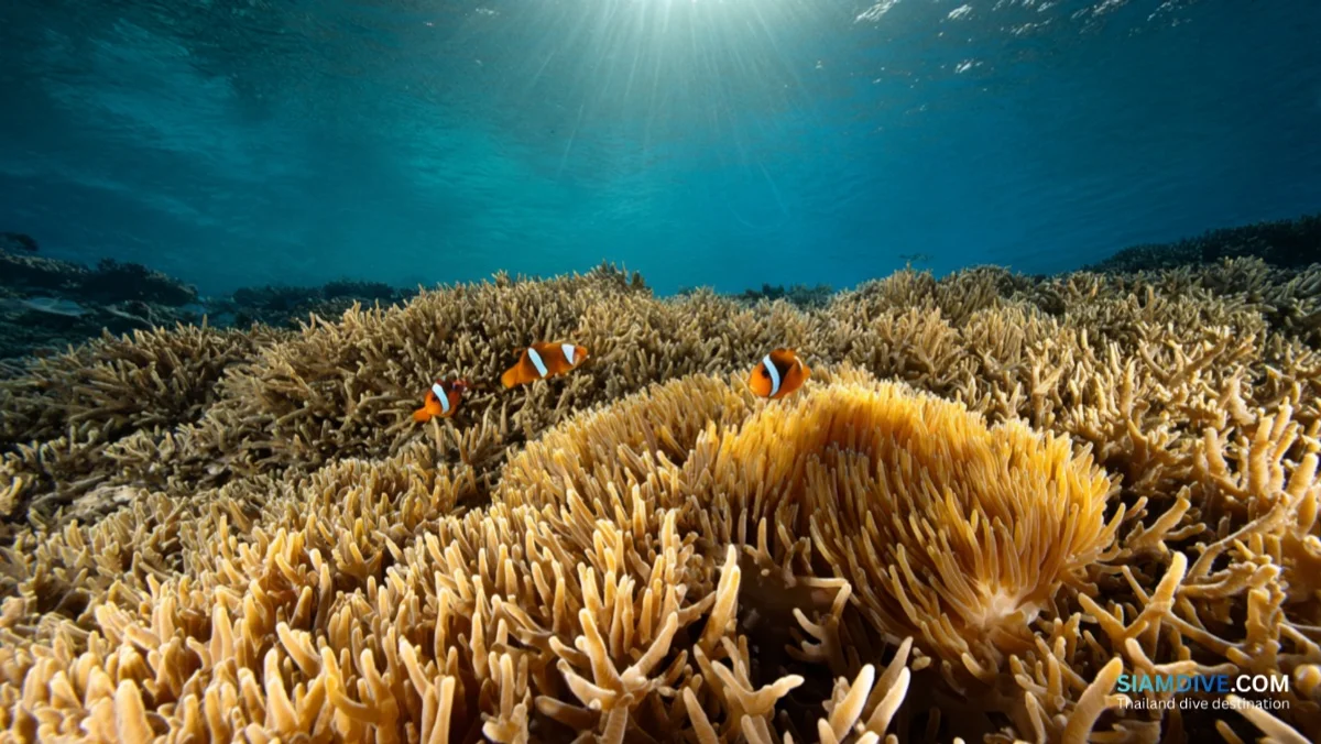
- Butterflyfish — obligate corallivores that feed on live coral polyps. A drop in butterflyfish density often provides the earliest warning that coral tissue is dying, sometimes weeks before bleaching becomes visible to the naked eye.
- Diadema sea urchins — nutrient-loading barometers. An explosion in Diadema density signals elevated nutrient runoff from land, because urchins thrive where algae blooms from excess nitrogen and phosphorus.
- Giant clams — collection-pressure indicators. In Thailand, giant clam populations track the intensity of shell harvesting in an area.
- Banded coral shrimp — aquarium trade markers. These decorative invertebrates are heavily collected for the aquarium industry, and their density on a reef correlates with collection intensity.
No single species tells the whole story. Taken together, these 24 organisms form a diagnostic panel. A reef with high coral cover but no groupers and declining parrotfish is headed for collapse that a casual recreational dive would never reveal — the kind of slow-motion failure that only consistent, standardised data can detect.
Thailand's Reefs in the Data
A coast-to-coast coral assessment published in January 2026 confirmed what many Thai dive professionals had suspected: the country's reefs are losing structural complexity. Branching and staghorn corals — the Acropora species that build the three-dimensional architecture fish depend on for shelter and feeding — are being recorded less frequently than in any previous national survey.
The 2024 marine heatwave pushed sea surface temperatures above 31 degrees Celsius for weeks across both the Gulf and the Andaman coast. In the worst-affected areas, up to 80 percent of corals bleached. Many recovered pigment, but the structural damage — snapped branches, flattened reef profiles — takes years to rebuild.
- 300+ species of reef-building corals documented across Thai waters
- 80% bleaching recorded in the hardest-hit areas during the 2024 heatwave
- 60,000 coral colonies in government nurseries under the 2025 national restoration plan
- 24 rai (~38,400 square metres) targeted for active coral replanting across seven provinces
- 1 coral cryobank opened at Phuket Rajabhat University in June 2025 to freeze larvae and symbiotic algae as a genetic insurance policy
A peer-reviewed study tracking Koh Tao's reefs from 2016 through 2024 found that coral health worsened even during the pandemic tourism halt, confirming that climate stress has overtaken local pressures as the primary driver of decline. Without consistent surveys, separating the damage caused by tourism, fishing, coastal development, and ocean warming is impossible — and without that separation, conservation budgets get spent on guesswork.
Thailand's reefs have proven they can bounce back when conditions allow. Similan's reefs demonstrated measurable recovery after the 2020 closures. But recovery only happens when managers have the data to identify which pressures to relieve first.
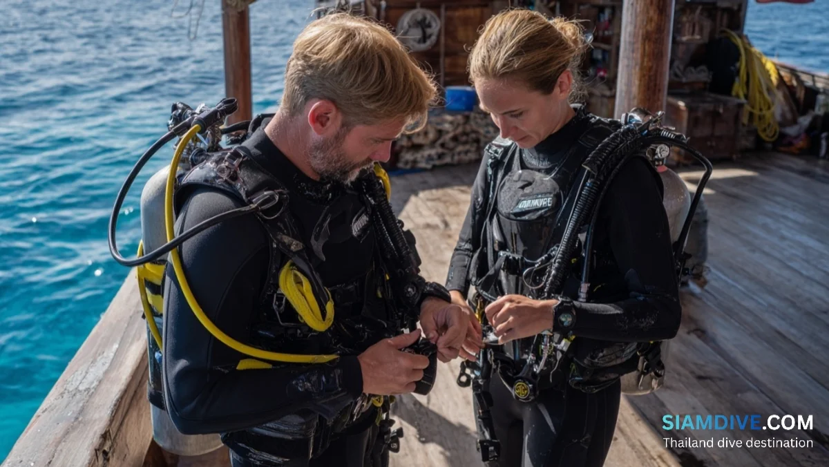
Three Days from Recreational Diver to EcoDiver
The Reef Check EcoDiver certification is a three-day course. It is the entry point for conducting official surveys whose data feeds directly into the global database used by governments and researchers worldwide.
Prerequisites are minimal but non-negotiable:
- Certification level: Advanced Open Water or equivalent, plus a buoyancy specialty
- Buoyancy control: the ability to hover at a fixed depth without touching the reef — a skill that demands more practice than most newly certified divers realise
- Dive fitness: comfortable completing 3 to 4 dives per day during fieldwork
The course splits into two halves:
- Classroom sessions (Day 1 and Day 2 mornings)
- Marine ecology fundamentals, the science behind indicator species selection, and identification training using photo guides and video. Fish ID covers the eight indicator families; invertebrate ID covers banded coral shrimp, Diadema urchins, giant clams, lobsters, and sea cucumbers. Substrate categories are drilled until identification becomes automatic.
- Field surveys (Day 2 afternoon and Day 3)
- Teams deploy the 100-metre transect at a local reef under instructor supervision. Each trainee rotates through fish counting, invertebrate counting, and substrate recording. Data is entered into the Reef Check mobile app on the surface and compared across the team for consistency.
After certification, EcoDivers must recertify annually. The requirement exists because identification accuracy degrades without practice, and a single misidentified grouper in a 20-metre segment can skew a site's fishing-pressure assessment for an entire survey cycle.
In Thailand, EcoDiver courses run regularly on Koh Tao, where permanent transects are resurveyed quarterly. Other locations schedule courses based on demand and season.
Where Thai Reefs Need Surveyors Most
Koh Tao is the most-surveyed island in Thailand — a function of its dive-training density and the permanent transects maintained by local conservation programmes. But Thailand's 2,600 km of coastline includes thousands of reef sites that see a formal survey once a decade or never.
The gaps follow a pattern:
- Upper Gulf — patch reefs around Koh Sichang, Sattahip, and the Eastern Seaboard rarely appear in any monitoring dataset
- Lower Andaman — reefs south of Koh Lanta toward Tarutao National Marine Park see seasonal dive traffic but almost no systematic surveys
- Deep Andaman sites — shallow transects exist at popular locations, but deeper boulder fields — including areas where ghost nets accumulate for centuries — lack repeat survey coverage
Every unsurveyed reef is a blind spot for Thailand's Department of Marine and Coastal Resources (DMCR). When the department allocates its annual conservation budget, sites with longitudinal survey data receive priority because they can demonstrate measurable trends. Unsurveyed sites compete for whatever remains.
A single EcoDiver team running four surveys per year at a previously unmonitored site creates baseline data that did not exist before — shifting that reef from invisible to fundable.
When Your Tally Sheet Reaches a Policy Desk
Reef Check survey data uploads to a publicly accessible global database. In Thailand, DMCR draws on this data alongside its own monitoring when drafting marine park management plans.
The distance from clipboard to policy is shorter than most volunteers expect. In early 2026, Thailand's Department of National Parks announced strengthened enforcement across marine parks in the Andaman and Gulf, including controlled access zones and fines reaching 8,700 baht (~$250) for damaging coral. The decision cited long-term monitoring data showing continued structural decline despite existing protections — exactly the kind of multi-year trend that only emerges from repeated, standardised surveys at the same sites.
The 158 blacktip sharks that returned to Phi Phi's Maya Bay became a national headline. But the decision to cap daily visitor numbers that enabled that recovery was built on survey data showing the bay's coral cover dropping below a critical threshold year after year.
Counting fish on a transect line will never generate the kind of photographs that go viral. There are no rescued animals, no time-lapse videos of coral fragments fusing to a frame. But every parrotfish tallied, every empty grouper column recorded, every substrate point marked as rubble instead of live coral adds one data point to a longitudinal record that no amount of restoration work can substitute.
A reef without data is a reef without a voice. The EcoDiver programme offers the microphone to any diver willing to learn the protocol — and Thailand has more reefs waiting to be heard than surveyors to listen.
Sources
- Reef Check Foundation — Tropical Monitoring Protocol and Transect Design
- Reef Check Foundation — About the EcoDiver Certification Programme
- Mongabay — Coast-to-Coast Assessment: Thailand's Reefs Losing Complexity (Jan 2026)
- Springer Nature — Coral Health Before and After COVID-19 Tourism Halt, Koh Tao
- Mongabay — Thailand's Coral Cryobank Buying Time for Dying Reefs (Feb 2026)